Land For Sale


Basic Details
Property Type:
Land
Listing Type:
For Sale
Listing ID:
113298
Price:
$78,000
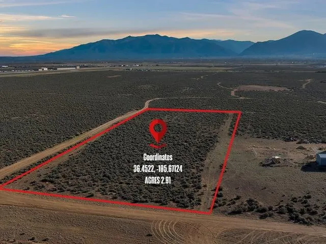
Lot Area:
3 Acre
Number of Acres:
3
Property Sub Type:
Unimproved Land
Features
Sewer
Septic Type Unknown,
Utilities
Electricity Available, Natural Gas Not Available, Phone Not Available,
Address Map
Country:
US
State:
NM
County:
Taos
City:
El Prado
Subdivision:
None
Zipcode:
87529
Street:
Avenida de Veronica
Street Number:
TBD
Longitude:
W106° 25' 29.5''
Latitude:
N36° 25' 56.1''
Mls Area Major:
COLONIAS LOWER (12A)
Directions:
Take Blueberry Hill to Lower Colonias. Take left on Rabbit Valley Rd. and continue onto Camino Tortuga. After 2.2miles take right on Loma Azul and continue around corner to Left to Avenida de Veronica. Proceed for 3 miles and property will be on your right. Last lot at end of the road. You will see the real estate signage.
Neighborhood
Middle School:
Taos
Elementary School:
Taos Elementary
High School:
Taos
MLS Addon
Office Name:
Berkshire Hathaway HomeServices Taos Real Estate
Agent Info
| No Image |
Evan Blish
|
